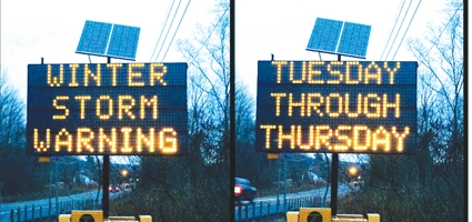
CHENANGO COUNTY – A severe winter storm that looks to impact the entirety of Chenango County is due to rear its ugly head by midday, tuesday.
Due to a a low pressure system slowly making its way up the east coast, a wintry mix of sleet, snow and rain is expected into the region.
Snowfall accumulations will be heavy through the duration of the event, and county residents are urged to prepare for the possibility of power outages and road closures. The storm will be a slow moving bring with it a lot of moisture with it resulting in snowfall accumulations between 13 and 19 inches according to NOAA forecasts – possibly more across eastern Chenango County.
By early to mid afternoon Tuesday, a wet mix will change to all heavy snow after 3 or 4 p.m. At its heaviest, the snow could pile up at a rate of one to two inches per hour, with a few isolated pockets with an estimated rate of two to three inches per hour later in the day.
With that amount of snowfall comes the increased likelihood of slick road conditions and significantly decreased visibility.
County Department of Public Works Director Shawn Fry said that his department is prepared with 19 trucks ready to take on the storm and three more on standby if needed.