In the shade of the sycamores, a gathering of parents and children rested on the library lawn and clapped at the jugglers and stilt-walkers performing for their pleasure. Just another leisurely summer day in Solvang, California. I only glimpsed this circus scene for a few seconds as I drove past on Highway 246, heading for the Tequepis Trailhead, but the thought went through my head: that looks like a much more enjoyable experience than I’m soon to be having.
For my final week in Southern California before departing for Montana, I had chosen to seek out an obscure relic from an outdated map – a jeep trail that wound from the Santa Ynez Valley floor to the top of 4,298-foot Santa Ynez Peak. Evidence of the road could no longer be viewed from the ground; I suspected that it been mostly erased by time and the steady encroachment of chaparral brush. The road originated on private property, so to reach it I would have to bushwhack through National Forest from the east, starting in the vicinity of the Outdoor School where I teach during the school year.
The search was marked with significant quantities of both trial and error. Twice I ventured up alternate jeep roads that climbed the flanks of Santa Ynez Peak for a thousand vertical feet before ending abruptly. Every potential route towards the primary jeep trail on my map became a dead-end, and I hesitated to bushwhack further because of heavy brush and poison oak. I was left with only one other option: I could dip into neighboring Circle V Ranch, which was currently hosting its summer camp, and if I wasn’t chased away too quickly, I was fairly certain I could find a connecting road that linked up with the jeep trail.
I decided to risk entering the property, even though I might be perceived as the “creepy guy” who lurks on the outskirts of camp. I hiked down one of the access roads into Circle V Ranch, but before I could come within sight of the main buildings, a cook came strolling up the road, looking for cell phone reception. He was a nice kid, who sympathized with my quest but did not have any encouraging advice for me. Still, the encounter spooked me enough that I gave up the hunt for the jeep trail as a lost cause and went home.
Five days later, I still felt unsettled about the whole affair. Motivated by lingering feelings of disappointment, I turned to satellite maps online and scanned them for any routes to the jeep trail that I might have overlooked. First, I found evidence of a road on the edge of Circle V Ranch, just past where I had encountered the cook. If only I had been less self-conscious and more persistent! However, I also noticed traces of trails on the top of chaparral ridgelines nearby. If I could reach them, then I could connect with the jeep trail and avoid the summer camp area altogether. The amount of bushwhacking involved appeared to be minimal.
I should have started packing for the trip to Montana, but instead, I drove back to the foot of Santa Ynez Peak for one last attempt. I chose a new access point, and dodged poison oak in the forests until I reached a ridgeline where I hoped to find a faint trail through the chaparral. But there wasn’t even the suggestion of one.
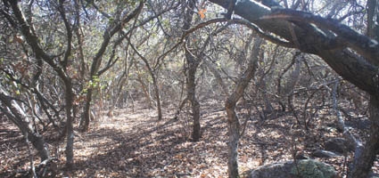
Chaparral bushes grow in the driest soils of coastal Southern California, and they are notoriously impenetrable. Their branches don’t bend and move out of the way; they either push back, or they snap and create jagged points like spearheads. Entering the chaparral is like going to war. Still, I was optimistic that I would find a trail sooner or later, so I plunged into the brush and began the attack.